 When FJC Magazine launched in 2008, we ran a series of three articles covering Off Road Navigation:
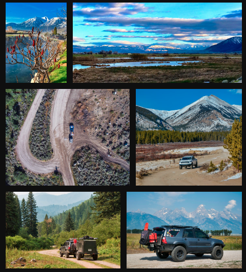
The great thing about using GE to preview our trip is that it makes it very easy to determine where we will start and finish each leg, and what the trail will be like. It’s also good to help visualize elevation gains/losses, potential scenic viewpoints and, to be honest, it helps us get through the work week leading up to our adventure. The additional layers available in GE (such as photos, hikes, mountain passes, peaks, etc) help make trip planning that much more exciting as well.
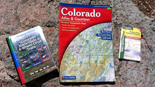
Once we have an idea of where we’re going, we can begin to narrow down exactly the trails we want to run, and sights we simply can’t miss. To do this, we use the FunTreks Guidebook for the area, if it’s available. There are other publications that can help with this as well such as our trusty Colorado Gazeteer from DeLorme, and books from other publishers. However we like the FunTreks books due to their spot-on descriptions, GPS and Mileage information, and useful photos.
Our guidebooks, combined with a Gazeteer and usually a National Geographic Trails Illustrated map constitute our paper map collection. These are very useful for the planning phases and as a reference when needed, but in all reality they’re not used very much on the trail. We’ve become very reliant upon our electronic devices to make navigation quick and easy, but it’s important to note that we NEVER leave the pavement without suitable paper maps as a backup. While we love our nav devices, paper maps & guidebooks work every single time.
Like our paper maps, our electronic systems are redundant, so we generally carry at least three different navigation devices with us at all times. First, our dedicated GPS is currently the tried and true Garmin eTrex Legend CX, and it works as well today as it did when we bought it five years ago. While it’s not the best user interface, it serves its purpose as a backup device. We’re looking forward to the new eTrex series that’s coming out in August as a much needed upgrade. Still, the Legend is exactly that: always dead on accurate, always works, and most of all it is baby proof. The iPhone is our secondary nav unit is useful for both on and off road navigation. Modern smartphones (both iDevices and Android, among others) are really coming into their own as far as vehicle navigation. With the plethora of apps available (we currently use Navigon for street nav and EveryTrail for off highway), there’s almost nothing you can’t do with a smartphone. The built in GPS and offline maps capability of smartphones make navigation easy, reliable, and affordable. If you’re going to have a smartphone anyway, you may as well use it to its full potential as a navigation device.
The iPad really is our holy grail of navigation. It takes all the great things about a smartphone and adds a huge 10” screen. The integration into the dash means off road navigation is almost a non-issue. There is little discussion on which way to turn at an intersection, and most times we don’t even have to stop when trails converge. Using the same apps that are available for the iPhone means we get twice the functionality from a single software purchase. While some will argue that the iPad is no replacement for a true PC based navigation solution, we’re sure that the cost and convenience differences more than make up for any tablet limitation.
Are all of these navigation options overkill? Maybe, but as we’ve said time and time again, make sure you have backups to your backups. When attempting to run trails with just the Gazeteer, figuring out which way to go ate up valuable trail time. Our ultimate off road navigation setup serves our needs well and keeps us moving nicely along the trail. We would love to hear what you use for off road navigation! Visit our Facebook page and let us know how you find your way in the woods.
More Photos!
[flickr set=72157627077433771]
Get a copy of the July issue!

NOTE: Internet Explorer users should right click and select "Save Target As"